Merging EVs with Google Maps

I recently purchased my first fully electric car (a 2023 Mustang Mach-E) and it’s been great! Thus far, I’ve been very pleased with every aspect of it.
I researched quite a bit before I made the purchase, so there have been very few surprises, but one little thing jumped out that I didn’t expect — the merging of Ford’s internal systems with Google Maps.
Like most (all?) electric vehicles, Ford has a built in navigation system that is pretty solid. However, I wanted to use Google Maps (since it knows more about me) inside of Android Auto, and I was curious about how well that would work. Somewhat surprisingly, it’s great!
There are two small reasons why.
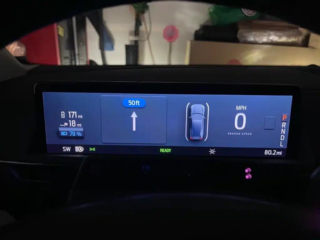
First, the car is able to pull data from Google Maps to show on the small instrument cluster just above the steering wheel, like this example showing “50ft”. That integration is nice.
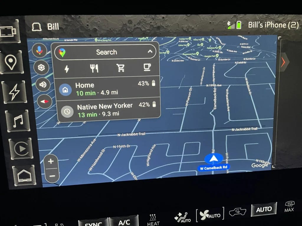
On the flip side, Google Maps can pull data from the car into the Maps app itself. A great example is in this screenshot; Google Maps is suggesting places you might want to go, and the percentage next to each one is an estimate of how much car battery you’ll have left after you arrive at that destination!
Neither one are major game-changers, but they’re both small integrations that I didn’t expect and I’m quite happy about. I assumed that Google Maps was walled off from the rest of the car (as it had been in all previous cars I’ve owned), so finding deeper integration like this is great to see.